
The Trimmu Barrage Project is a historically significant and strategically vital water management structure in Pakistan. Built on the Chenab River, this barrage has played a key role in irrigation, flood control, and regional stability for decades. With modernization efforts and advanced monitoring systems, the project continues to operate efficiently while meeting today’s engineering standards.
Project Overview
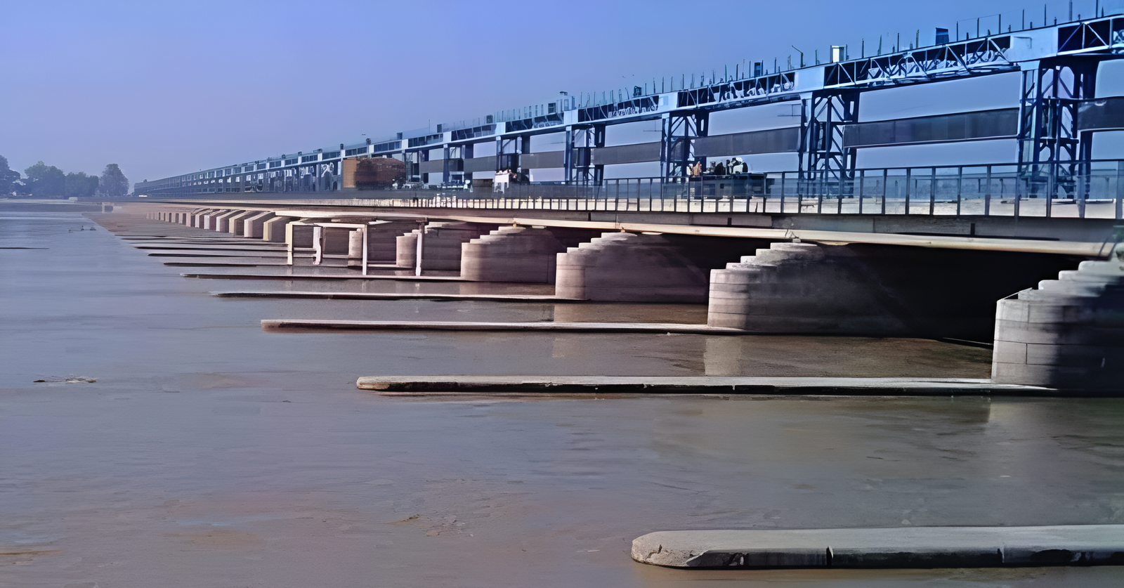
The Trimmu Barrage, formerly known as Emerson Barrage, is located near Trimmu, approximately 25 km from Jhang. It was originally constructed between 1937 and 1939 by British engineers to regulate water flow and protect surrounding areas from flooding.
Key Highlights:
- River: Chenab River
- Construction Period: 1937–1939
- Primary Purpose: Irrigation and flood control
- Location: Near Jhang, Punjab, Pakistan
Over time, the barrage has undergone modernization and rehabilitation, including the installation of new gates and reconstruction of bridge components to improve efficiency and durability.
Importance of Trimmu Barrage
The barrage plays a crucial role in regional infrastructure:
✔ Controls water flow for irrigation
✔ Protects nearby areas from flooding
✔ Supports agricultural productivity
✔ Enhances water distribution systems
Its continued operation is essential for maintaining stability in the surrounding agricultural regions.
Advanced Monitoring System
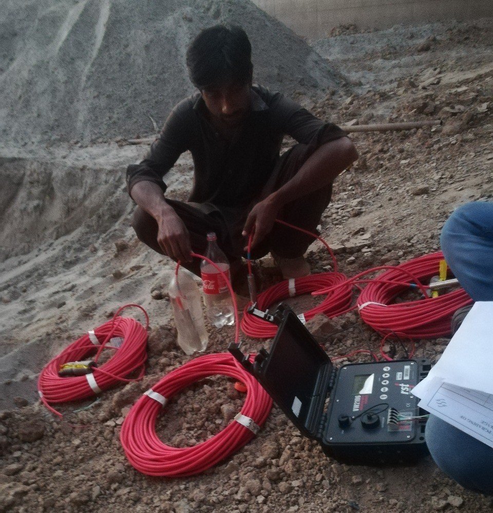
To ensure structural integrity and operational safety, the project incorporates a modern monitoring system using advanced instrumentation.
Monitoring Instruments Installed
The following technologies are used for continuous monitoring:
- Vibrating Wire Piezometers – measure internal water pressure
- Standpipe Piezometers – monitor groundwater levels
- Multiplexers – manage multiple sensor signals
- Dataloggers – collect and store monitoring data
- Radio Tx/Rx Systems – enable remote data transmission
- Water Level Indicators – track water levels
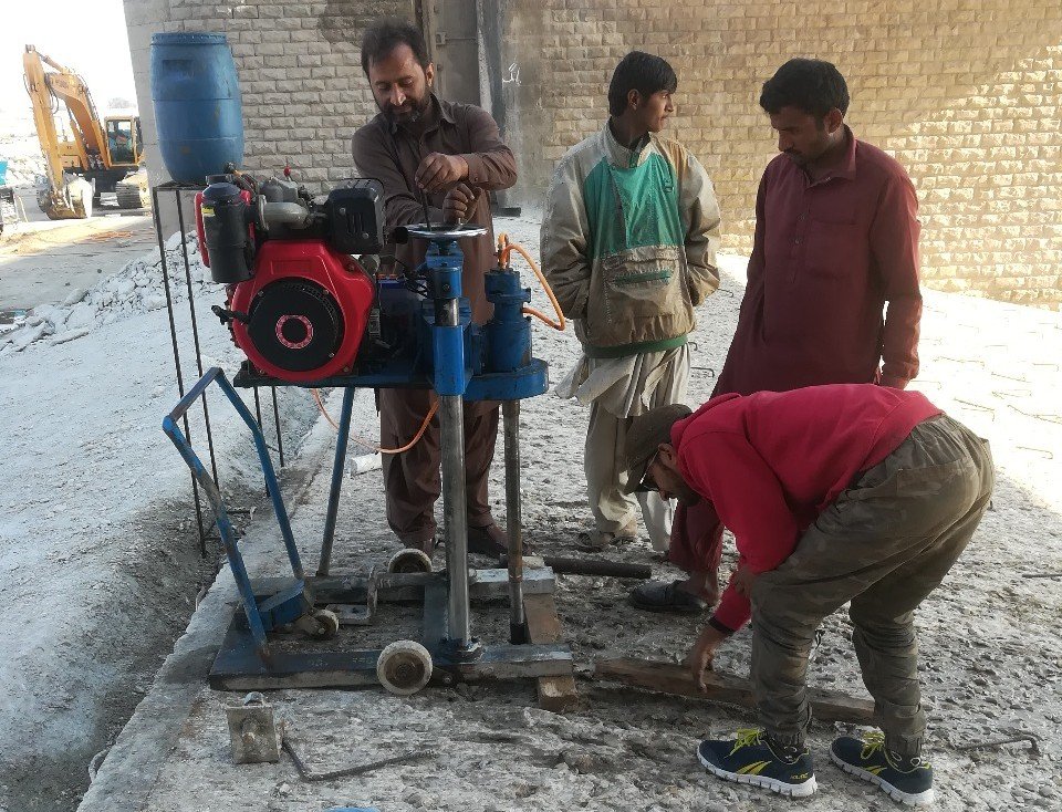
How the Monitoring System Works
The system is designed for real-time data collection and analysis:
- Sensors gather structural and hydraulic data
- Multiplexers organize signals from various instruments
- Dataloggers record the data continuously
- Radio systems transmit data for remote monitoring
- Engineers analyze the data to ensure safety and performance
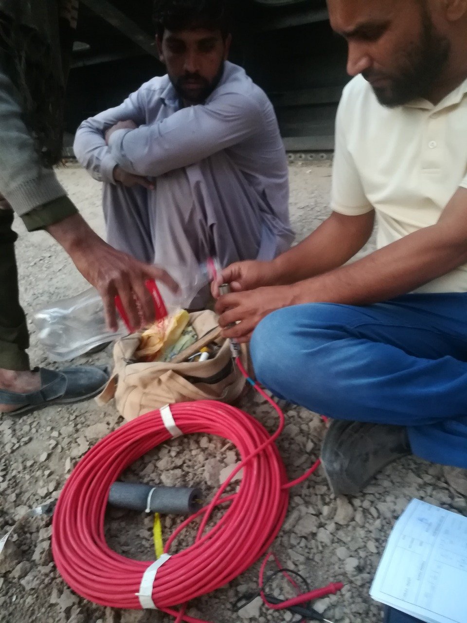
This system helps detect:
- Seepage and leakage
- Pressure variations
- Structural stress
- Water level fluctuations
Technologies & Products Used
The project utilizes reliable and high-precision instrumentation:
- VW (Vibrating Wire) Piezometers
- Standpipe Piezometers
- Multiplexers
- Dataloggers
- Radio Communication Systems
- Water Level Monitoring Devices
These tools provide accurate and continuous monitoring of the barrage.
Key Benefits of the Project
1. Enhanced Structural Safety
Continuous monitoring reduces the risk of failure.
2. Improved Flood Control
Helps manage water flow effectively during high discharge periods.
3. Efficient Irrigation System
Ensures reliable water supply for agriculture.
4. Long-Term Sustainability
Modern upgrades extend the lifespan of the barrage.
Project Stakeholders
- Client: PMO
- Consultant: NESPAK
- Specialist Contractor: GSI (Geotechnical & Structural Instrumentation)
These organizations collaborated to deliver a modernized and efficient monitoring system.
Conclusion
The Trimmu Barrage Project is a strong example of how historic infrastructure can be upgraded to meet modern demands. Through rehabilitation and the integration of advanced monitoring technologies, the barrage continues to serve as a reliable water management system.
Its role in irrigation, flood control, and regional development makes it a critical asset in Pakistan’s infrastructure network.
FAQs
What is the purpose of Trimmu Barrage?
It regulates water flow for irrigation and provides flood protection.
When was it constructed?
Between 1937 and 1939.
Which monitoring instruments are used?
Piezometers, multiplexers, dataloggers, and water level indicators.
Why is this project important?
It supports agriculture, manages floods, and ensures infrastructure safety.